We couldn't stay still for very long so we packed our bags and headed north-east for an adventurous three-day weekend. Our destination, again, was Mena, Arkansas. This time we decided to take Highway 259 through Broken Bow and Hochatown, Oklahoma. Outside of Hochatown, we stopped on the side of the road to take a look at Mountain Fork River which feeds into Beavers Bend State Park.
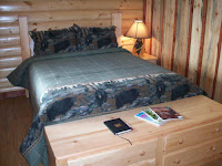
Before leaving DFW we made reservations at the Mena Mountain Top Cabins and we were not disappointed! These adorable, rustic cabins sit on top of a sort-of-mountain and have breath-taking views of the Ouachita mountains.
Each cabin has a kitchenette, living area, bathroom, separate bedroom and screened-in patio.
After a good night's sleep in the Bear Den we headed southeast on Highway 8 in search of fall color. Fall is a great time of year to visit Arkansas because it’s one of the best places to see fall foliage. Every autumn, nature paints the mountains and valleys of The Natural State with gorgeous hues of gold, red and orange. It looked as if we arrived a little too early to see good color until we entered the Ouachita National Forest. Sections of the forest were starting to pop.
Off Highway 8 we took a dirt road (SUV is a necessity in this area) and followed the signs to Little Missouri Falls. This area is heavily used by ATVs so we had to be careful traveling on the narrow, twisting roads. Little Missouri Falls is a forested picnic area that has several hiking trails that lead to the waterfall's overlooks so that's what we decided to to.....hike to the falls!
Leaving Little Missouri Falls we headed to Albert Pike Recreational Area. This area suffered considerable damage an approximately 20 people lost their life when the Little Missouri and Caddo Rivers flooded in June of 2010. We were sad to see that the campground was still in ruins and there is no overnight camping allowed. From what we understand the National Parks Department has done nothing to revive this campground.
Leaving Albert Pike Recreational Area we headed east on Highway 84 and connected onto Highway 70 arriving at the town of Glenwood. It was somewhere in this area that TK spotted Bigfoot (have we mentioned TK's obsession?) It seems Bigfoot was ready for a night of trick-or-treating - it was Halloween, after all!
From Glenwood we traveled northeast on Highway 28/8 through the town of Caddo Gap. This town had such a resort feel to it that we decided to drive through the town and learn about its history.
Caddo Gap is best known as the area in which explorer Hernando de Soto and his forces clashed with the Tula tribe, a band loosely affiliated with the Caddo Confederacy. The expedition described the Tula Indians as the fiercest they had faced during their inward journey into North America.
After this, the expedition turned back east, making it as far as the Mississippi River, where de Soto died. It is contested as to whether he died of fever, or from a wound received during the fighting. There the expedition had a secret burial ceremony and sent his body into the river.
A monument to this event stands in the heart of the small community, which now has a population of fewer than 100.
With more knowledge about Caddo Gap we headed back to Mena and called it a day.
The next morning we left Mena and traveled through the Quachita Mountains via the Talimena Scenic Drive. Unfortunately the scenic drive wasn't very scenic due to a blanket of fog covering the mountains. The fog was so dense that we could barely see the Queen Wilhelmina Lodge.
We stopped at the lodge to stretch our legs and hike a small portion of the Quachita Trail to a rock formation known as Lover's Leap. The Lover's Leap trail winds through the woods to an overlook on the south face of the mountain. This is a place where an Indian maiden once took her own life--or so legends say.
Sadly, we had to leave beautiful Arkansas and eastern Oklahoma and get back to our work week in DFW. Goodbye Natural State - we will see you soon!
| |
|
|
 |
| Mena Mountain Top Cabins |
|
|
|
 |
| Us, outside our cabin |
 |
| Visitors outside the cabin |
After a good night's sleep in the Bear Den we headed southeast on Highway 8 in search of fall color. Fall is a great time of year to visit Arkansas because it’s one of the best places to see fall foliage. Every autumn, nature paints the mountains and valleys of The Natural State with gorgeous hues of gold, red and orange. It looked as if we arrived a little too early to see good color until we entered the Ouachita National Forest. Sections of the forest were starting to pop.
 |
| Views of Quachita National Forest |
 |
| Views of Quachita National Forest |
 |
| No paved roads to Little Missouri Falls |
|
|
 |
| Little Missouri River |
 |
| Little Missouri Falls |
 |
| Little Missouri Falls |
 |
| Little Missouri Falls |
 |
| Parking lot of closed campground |
 |
| Armadillo crossing the road |
 |
| Little Missouri River at Albert Pike |
 |
| Rock Spring Cemetery within Albert Pike |
 |
| We should have a bumper sticker that reads: "Brakes for Cemeteries!" |
 |
| Ghost of Bigfoot? |
From Glenwood we traveled northeast on Highway 28/8 through the town of Caddo Gap. This town had such a resort feel to it that we decided to drive through the town and learn about its history.
Caddo Gap is best known as the area in which explorer Hernando de Soto and his forces clashed with the Tula tribe, a band loosely affiliated with the Caddo Confederacy. The expedition described the Tula Indians as the fiercest they had faced during their inward journey into North America.
After this, the expedition turned back east, making it as far as the Mississippi River, where de Soto died. It is contested as to whether he died of fever, or from a wound received during the fighting. There the expedition had a secret burial ceremony and sent his body into the river.
A monument to this event stands in the heart of the small community, which now has a population of fewer than 100.
 |
| Caddo/Desoto Monument |
The next morning we left Mena and traveled through the Quachita Mountains via the Talimena Scenic Drive. Unfortunately the scenic drive wasn't very scenic due to a blanket of fog covering the mountains. The fog was so dense that we could barely see the Queen Wilhelmina Lodge.
 |
| Mountains? What mountains? |
We stopped at the lodge to stretch our legs and hike a small portion of the Quachita Trail to a rock formation known as Lover's Leap. The Lover's Leap trail winds through the woods to an overlook on the south face of the mountain. This is a place where an Indian maiden once took her own life--or so legends say.
 |
| Trail markers |
 |
| Quachita Trail marker |
 |
| View from top of Lover's Leap |
Sadly, we had to leave beautiful Arkansas and eastern Oklahoma and get back to our work week in DFW. Goodbye Natural State - we will see you soon!


